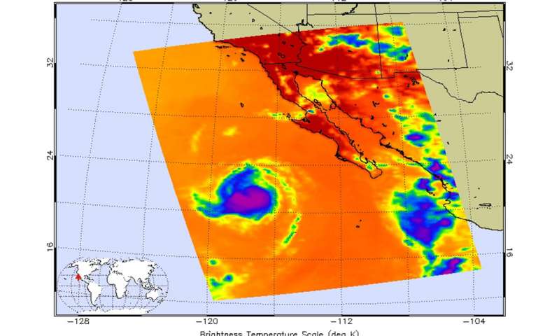
Infrared data from NASA showed that cloud top temperatures in Hurricane Frank were warming, an indication that Hurricane Frank was getting weaker.
Infrared data taken July 26 at 2053 UTC (4:53 p.m. EDT) from the Atmospheric Infrared Sounder or AIRS instrument that flies aboard NASA’s Aqua satellite revealed that Frank was a compact storm. The center was surrounded by a small area of strong thunderstorms where cloud top temperatures were warming as the uplift of air weakened, not pushing cloud tops as high into the troposphere.
Frank is a small tropical cyclone. Tropical-storm-force winds extend outward up to 60 miles (95 km) from the center
On July 27, the National Hurricane Center noted that Frank was quickly weakening and the strongest storms were shrinking in area, located northwest of the center.
At 11 a.m. EDT (1500 UTC) Frank weakened from a hurricane to a tropical storm. The center of Tropical Storm Frank was located near latitude 22.7 North, longitude 120.8 West. About 695 miles (1,115 km) west of the southern tip of Baja California, Mexico.
Frank is moving toward the west-northwest near 12 mph (19 kph) and this general motion with some decrease in forward speed is expected over the next 48 hours. Maximum sustained winds have decreased to near 65 mph (100 kph) with higher gusts.
Steady weakening is expected due to the cyclone moving over progressively colder waters and into a more stable air mass.
[Source:- phys org]


